
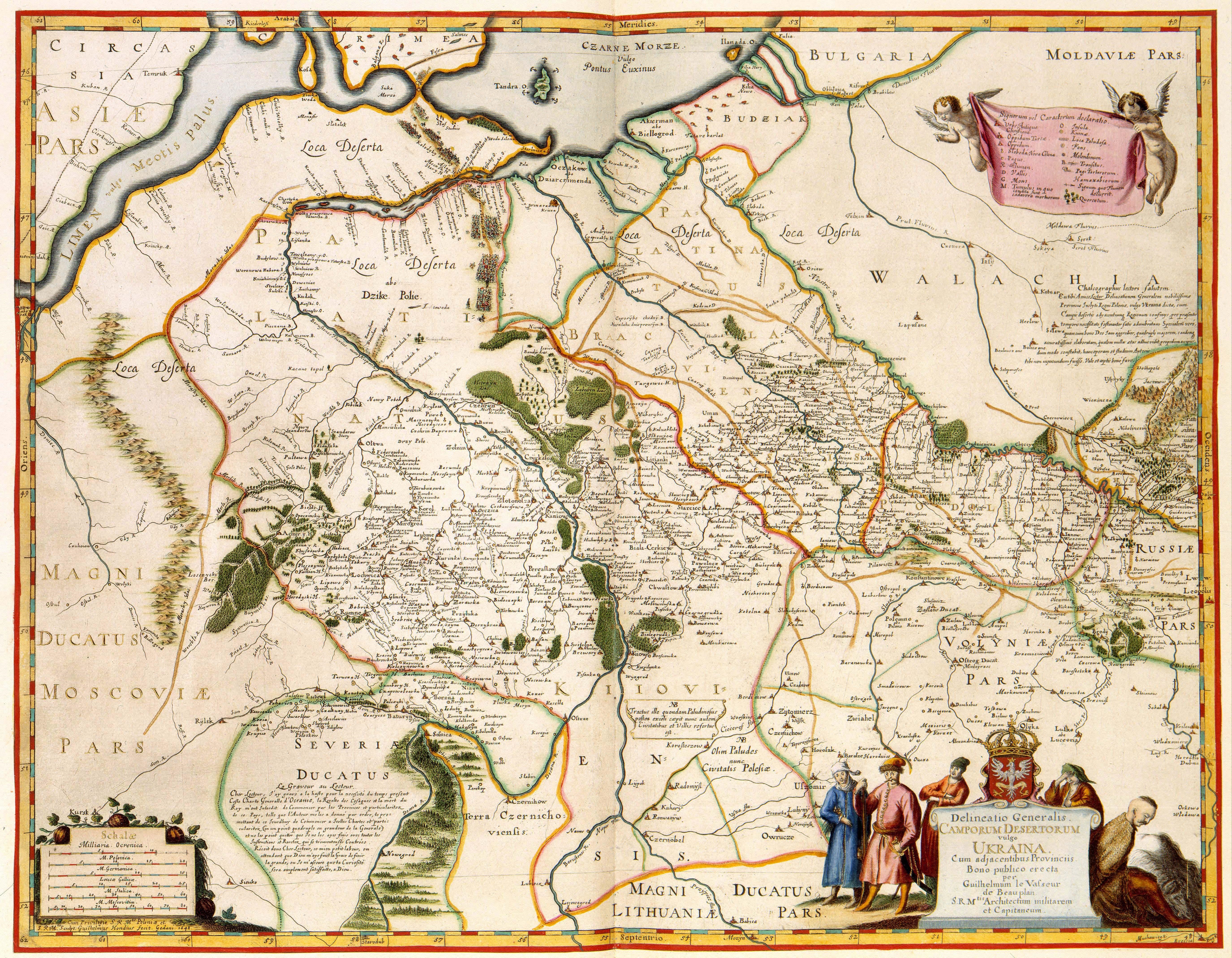
Guillaume le Vasseur de Beauplan. Ukraine. Camporum Desertorum. 1648
Розділ: Мапи Волині
Delineatio Generalis CAMPORUM DESERTORUM vulgo UKRAINA, Cum adjacentibus Provinciis Bono publico erecta (пер.: Загальний план безлюдних полів, широко відомих як УКРАЇНА, з суміжними провінціями, зведеними для суспільного блага)
Description/Опис:
Ukraine was divided between Poland and Russia in the 17th century. In order to control this enormous territory and protect it against enemies, the Polish king Ladislaus IV had the area mapped by the French soldier Guillaume le Vasseur de Beauplan (1595-1685). This overview map of the Ukraine was compiled by de Beauplan in 1639, engraved by Willem Hondius (ca. 1597-before 1660) and published by the same Hondius in Gdansk in 1648.
(пер.: У XVII столітті Україна була поділена між Польщею та Росією. Щоб контролювати цю величезну територію та захистити її від ворогів, польський король Ладислав IV наказав французькому солдату Гійому ле Вассеру де Боплану (1595-1685) нанести цю територію на карту. Ця оглядова карта України була складена де Бопланом у 1639 році, вигравірувана Віллемом Гондіусом (бл. 1597-перед 1660 роками) і опублікована тим же Гондіусом у Ґданську в 1648 році).
Author/Автор: per Guilhelmum le Vasseur de Beauplan SRMtis Architectum militarem et Capitaneum ; SRMtis
Sculpt/гравюри: Guilhelmus Hondius fecit, Gedani 1648
Publisher/видавець: Willem Hondius
Year of manufacture/Дата публікації: 1648
Manufacturing site/Місце видання: Gdańsk
Institution: British Library
Copyright for information: Royal Library, The Hague
Source/Джерело: