
Daniel de Lafeuille. Le Royaume de Pologne avec ses Confins. Generale Kaart van Polen. 1706 (1747)
Розділ: Мапи Волині
Artist: Daniel de Lafeuille (1640–1709)
Title: Le Royaume de Pologne avec ses Confins. Generale Kaart van Polen.
Description: A stunning map of Poland first drawn by Daniel de la Feuille in 1706. Covers the entire territory of Poland as well as parts of Latvia, Prussia, Hungary, Transylvania, Moldova and Russia. Flanked on either side by the twelve armorial crests of Poland and its immediate neighbors. Title appears at the top center in both French and Dutch. This is Paul de la Feuille’s 1747 reissue of his father Daniel’s 1706 map. Prepared for issue as plate no. 31 in J. Ratelband’s 1747 Geographisch-Toneel .
(пер.: приголомшлива карта Польщі, яку вперше склав Даніель де ля Фей у 1706 році. Охоплює всю територію Польщі, а також частини Латвії, Пруссії, Угорщини, Трансільванії, Молдови та Росії. Обабіч дванадцяти гербів Польщі та її найближчих сусідів. Назва відображається вгорі по центру французькою та голландською мовами. Це перевидання Поля де ла Фея 1747 року карти його батька Даніеля 1706 року. Підготовлено до випуску як табл. 31 у Geographisch-Toneel Дж. Рательбанда 1747 року).
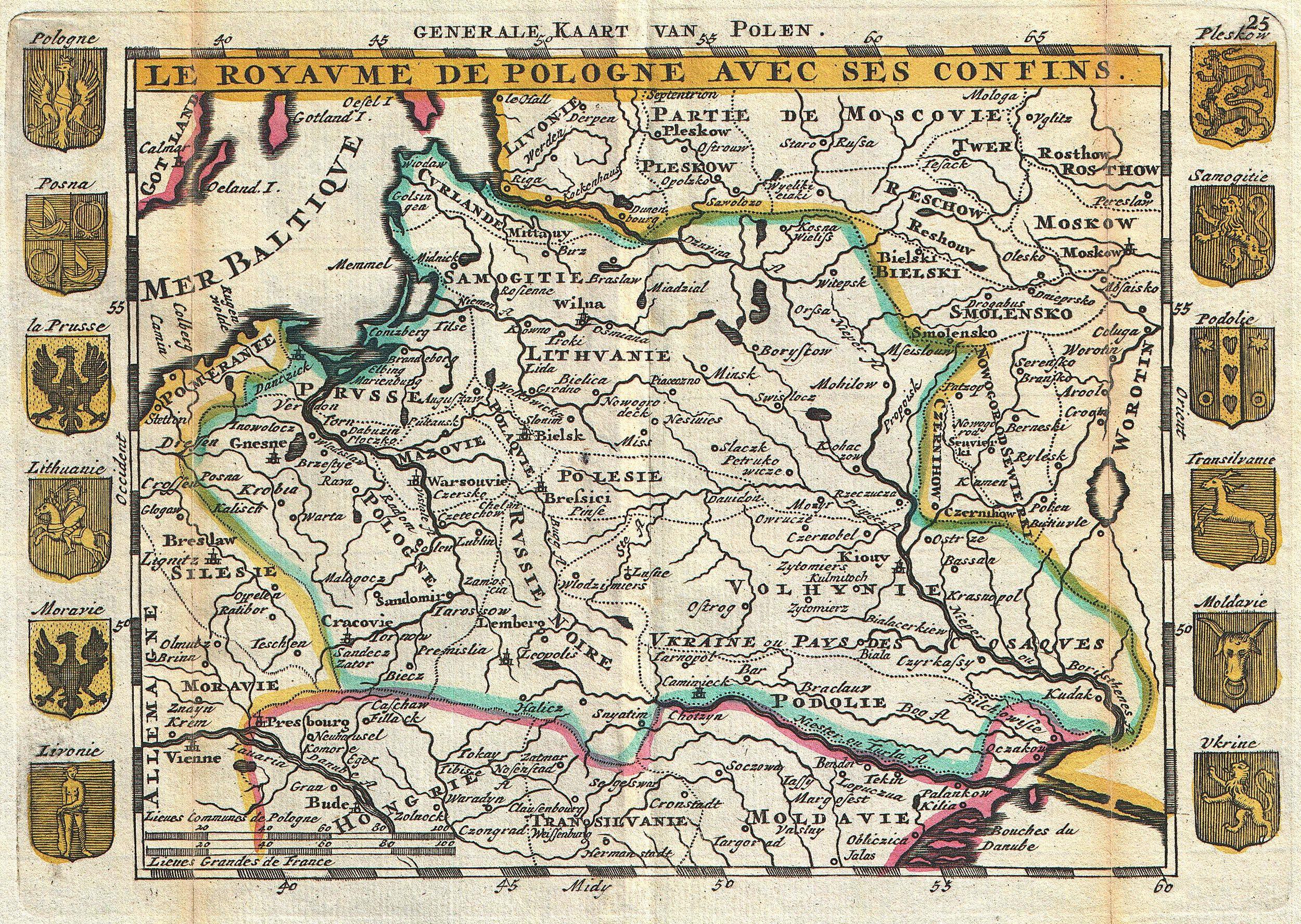
Date: 1747
Dimensions: height: 6 in (15.2 cm); width: 8.5 in (21.5 cm)
Geographicus link: Pologne-ratelband-1747
Source/Photographer: Geographisch-Toneel Of uitgezochte Kaarten, Tot gemak der Officieren, Reisigers en Liefhebbers; Behelsende alle de generale Kaarten ..., (1747 J. Ratelband issue.)
Джерела:
Wikimedia Commons
Geographicus Rare Antique Maps

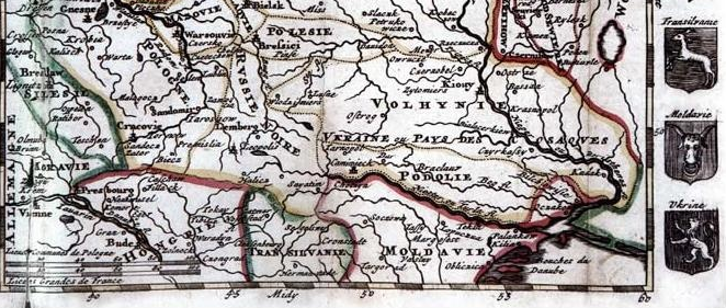
1702 р. А. Феротей де ля Круа – Даніель де ля Фей. На мапі «Le Royavme de Pologne avec ses confins» (Польське королівство з його кордонами) французького картографа Феротея де ля Круа (Phérotée de la Croix; 1640-1715) та голландського гравера Даніеля де ля Фея (1640–1709) зазначено "Ukraine pays des Cosaqyes" (Україна земля (країна) Козаків). Напис проходить уздовж Волині, Київщини і Поділля. Галичина та Берестейщина окреслені як Rvssie Noire (Чорна Русь), окремо від "України". На північному сході України виділено Polesie (Полісся).
Джерело:
Андрій Байцар. Назви «Волинь» та «Полісся» на європейських картах. XVI-XIX ст.